Firedoglake: CSI
Mickey Kaus sent me a link and let me know he has now dubbed us "Firedoglake: CSI." Which I must say I'm quite proud of. So I don't want to let Mickey down.
An overabundance of Chief Wiggams in Kenedy County have now bungled the investigation and stalled it until everyone got a chance to get their stories straight, but fortunately these people are so accustomed to lying without challenge they don't do it very well.
Reader TE sent me the following email, which I find quite interesting:
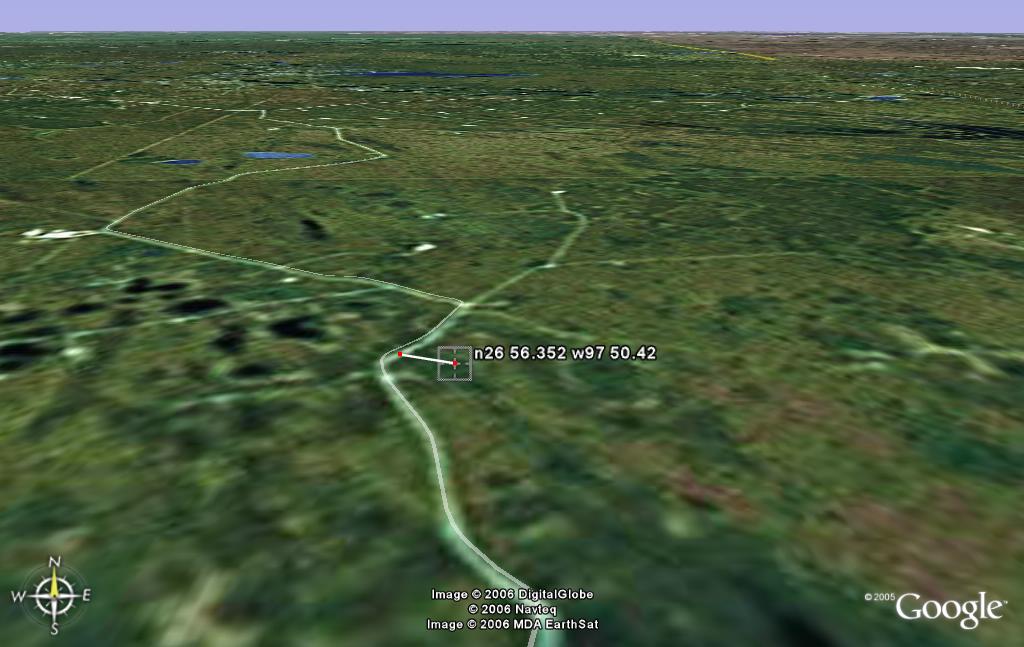
Don't know if any of your other readers noticed this but the Sheriff included the approximate GPS coordinates of where he was told the shooting took place according to the group (N26 56.352 W97 50.42). I plugged those into Google Earth and it comes up in South Texas rural area. I was only able to zoom into and measure from what looks like the only road near the incident. In every measurement I took the road is from 450 to 550 feet from where the incident happened. According to the report the women were in the car on this road and were pretty far away. In the report Cheney also notes that Whittington was at a lower elevation than him, and that's why he got hit in the face. From the GPS coordinates given I did a 100ft circle around that to see the changes in elevation and they are less than 1 Foot. Maybe some of your other readers can get better access to or have more experience with satellite data. Someone could also do a flyover of the exact coordinates given if they have time.The picture above is from Google Earth. Cheney has said over and over that Armstrong was an "eye witness." But wouldn't the account of Pamela Willford, who was ostensibly standing right next to Cheney at the time, be much more reliable? Where is she now? And what about her husband? Is he shaping up to be the Andrew Parker Bowles in all of this?
posted by Jane Hamsher @ 2/16/2006 08:29:00 PM
![]()
![]()


<< Home